
From collection Place

State of Maine created from the Commonwealth of Massachusetts' District of Maine. The geographic center, or that point on which a surface of uniform thickness would balance, for the state is located in Piscataquis County, 18 mi N of Dever.
Related Items
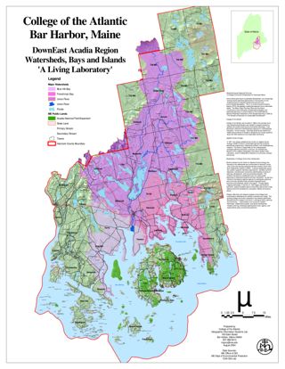
Downeast Acadia Region Watersheds, Islands, and Bays
A Living Laboratory. This project is in ESRI GIS Story Map format.
Solar Potential of High Electricity Cost States
These maps support the business plan of ImpactGreen with the goal to eliminate fossil fuels from electricity production. This project is in ESRI GIS Story Map format.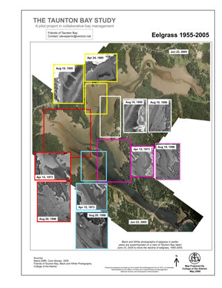
The Taunton Bay Study: Eelgrass 1955-2005
Changes in Eelgrass over time in Taunton Bay, headwaters of Frenchman Bay. This project is in ESRI GIS Story Map format.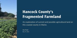
Hancock County's Fragmented Farmland
An exploration of current and possible agricultural land on this coastal county in Maine. This project is in ESRI GIS Story Map format.
State Senate certification
A certification that the named person is a member of the state senate of Maine's 100th legislature.
Abortion Access in MaineEva McMillan
Abortion accessibility in Maine is unique because of the state's size and rural population. With long drive times presenting a barrier for many individuals, expanding access to later abortion care should be a priority. This project is in E…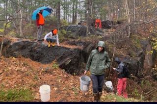
Rocks and Minerals in Maine
The Rocks and Minerals class of Fall, 2021 taught by Sarah Hall has created an exhibit in the Dorr museum showcasing their collections. These collections are samples of a range of rocks and minerals found in Maine which, when viewed, show …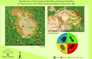
Distribution of Four Ground-Dwelling Arthropod Families
Distribution of Four Ground-Dwelling Arthropod Families in Traps Across Pine Hill and Settlement Quarry, Deer Isle, Maine. This project is in ESRI GIS Story Map format.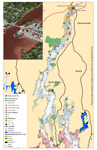
Maine Oyster Trail Pilot Project, Damariscotta River
A Map showing land use, waterfront access, and other factors important to Oyster aquiculture. This project is in ESRI GIS Story Map format.

